
At long last, I am back to hiking. It is nice getting some fresh air and exercise, and Hawaii is the perfect place for that.
The day didn't start out well. The hiking trail I wanted to do this morning on Schofield Barracks was closed due to training. What kind of training you ask?
 |
| If you get this reference, then a virtual high five to you |
Since I didn't want to get shot at or blowed up, I set out to find a different hike. There were several in the area, but I wasn't prepared to be out all day or ascend 2000 feet using ropes. I decided to try out a trail that I had started twice before but never finished.
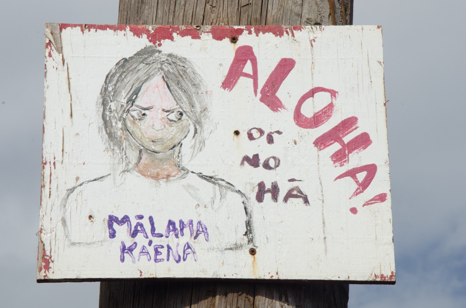 |
| This either means "show love to Ka Ena Point," or "I'm going to steal the valuables out of your car while you're out here." |
Ka Ena Point is the western tip of Oahu. It is about as far away from Waikiki as you can get and still be on this island. It's also one of the best places to find solitude on an overcrowded island.

At one point in time, they tried to make a road that wrapped all around the point of the island, connecting the Waianae coast and the Hale Iwa north shore coast. It was a good idea on paper, because the trip from Waianae to Hale Iwa is well over an hour, but is only a few miles as the crow flies. Unfortunately, mother nature did not agree with this project and decided to sweep away part of the road using her strong ocean currents. The terrain is still passable most of the way using a 4WD vehicle, but it also makes for a spectacularly easy hike.

There are two ways to reach the point, from the west side or from the north side. I have done the west side before, and it was a pretty incredible stroll along the coastline. I have twice before attempted the hike from the north shore, and both times I was forced to turn around due to the crabbiness of a toddler. Well, this time I was prepared (by that I mean without kids).

The trail itself is pretty plain. As I said, it's a 4WD dirt road that you walk along. You are treated to views of small mountains to the left, and a rocky ocean shoreline to the right. There are several coves and lookouts that one can stroll to and along. Some good views, but mostly nondescript.

The very end of the trail is a nature preserve. It is somewhat of a bird sanctuary and a monk seal safe haven. The below sign is posted at the gate to warn people of the dangers of bringing dogs to Ka Ena Point. After looking at the sign, all I could think of was how much fun my dogs would have digging up the birds out of their holes. I know, there is something wrong with me.

The terrain gets sandy once you enter the gate. You walk past bushes and bird holes as you approach the navigational aid. Next to the navigational aid there is a small, abandoned building. I read a news story that some artist spray painted a mural on the wall, so that was one of the reasons I was thinking about this hike on this particular day. The article also said the county considers this graffiti and has already painted over one of this guy's other works.

Now, I'm not really one for art, but I can appreciate what this guy can do with a can of spray paint. If I tried to do something like this, I would just end up with a brownish blob of paint that roughly resembles the spaghetti stain my kids get on their clothes every time we eat Italian.


Just past the navigational aid is a rocky area where monk seals like to hang out. I caught this little guy sunbathing while I was eating my snacks.
 |
| No Monk Seals were harmed in the production of this blog. |
 |
| The crab, however, was delicious |
While I was resting, I decided to play around with the 105mm macro lens that my dad sent me. That basically means I can take really up close pictures of small objects. This thing can really come in handy.


I have been reading books and watching videos by this photographer named Bryan Peterson. He has a fantastic beginner photography book titled "understanding exposure," where he goes through the basics of exposure theory and makes it easy for the laymen to understand. Bryan is also big into texture photographs. I decided to try my hand at a few of them while I was out there...
 |
| Purple pattern on one of the rocks |
 |
| Rust on one of the metal boxes lining the nature preserve area |
 |
| the last time I tried to make brownies |
And with that I will leave you with more pictures from the hike. Enjoy and Mahalo for reading!


