Showing posts with label oahu. Show all posts

Thursday, May 15, 2014

Lanikai Pillbox Hike (Ka'iwa Ridge Trail)


This hike is one of my absolute favorite hikes on the island.  It is short, kid-friendly, close to my house, and offers a relatively high reward for the little amount of effort it takes to get here.  It offers fantastic sweeping views of the windward side of Oahu from Kaneohe all the way to Waimanalo, Bellows, and beyond.  It prominently features the two mascots of Kailua and Lanikai- the Mokulua Islands.


Na Mokulua, the official name for the islands, means "the two islands" in Hawaiian. (I believe "Na" itself is short for "Na Really").  The one on the left is Moku Nui.  The one on the right is Moku Iki.  Most people just call them "the Mokes."


Both are bird sanctuaries and visits are regulated by the Department of Land and Natural Resources.  Many people kayak there from Kailua Beach, but you must buy a permit for landing on the beach of Moku Nui.  Moku Iki doesn't have a beach at all, so it's not really possible to land a kayak there.


Hey man, you're wrecking my aloha


The one bad thing about this hike is parking is extremely limited.  There are a few spots on the side of the road near the trail head, but once those are taken you must use street parking in front of someone's house.  As you can imagine, the locals have had many problems with hikers blocking driveways, leaving trash in their yards, using their hoses without permission, being loud and disruptive, and other such lapses in common courtesy.  If you hike here (or anywhere, really), be respectful of the residents and act like you are a guest on their land.


This hike is a fairly short climb through a wooded area followed by a bit of ridge walking.  My wife gets scared every time we let the kids wander around by themselves because she is afraid they will go tumbling down the mountain.  I am proud to say we have yet to lose a kid on this hike.


The trail leads to two World War II-era defensive positions (hence the "Pillbox").  The large guns and other fun stuff have long since been removed, but you are instead treated to a gallery of artwork from local youths.


I am told the trail continues to a third pillbox, but most people turn around at the second pillbox.  I have never ventured much past #2, despite the many times I have done this hike.


One of the things I like best about this hike is the opportunity to see just how clear the water is over here.  The light blue colors are the sand, the brownish colors are the coral.  Look how easy it is to see to the bottom even from this height.  (This also makes for great snorkeling)


Many people venture here to watch the sun rise.  I am normally not that masochistic.  However, I did make it up here one morning that I woke up early intending to do the Haiku Stairs again, but was turned away by some local fuzz. I think it worked out well for me.


I had the pillboxes to myself for a few hours and I took the opportunity to attempt some star trails.


Overall, this is a fantastic hike with a great payoff for a little amount of effort.  I would recommend this to anyone.


Wednesday, July 17, 2013

Haiku Stairs: The Forbidden Fruit


Gather 'round kids.  Grandpa has another story for you.  Back in my day, we didn't have these fancy cell phones or satellite communications.  If we wanted to send messages over long distances, we either had to use carrier pigeons, or shoot radio waves from mountaintop to mountaintop.  How did we get this radio equipment to the top of the mountain?  We took the stairs!


Way back in 1942, the US Navy constructed some communications towers on Oahu that were capable of communicating with the fleet as far away as the Sea of Japan.  Naturally, these sites needed to be at the top f the highest mountains to get the maximum possible reach.


To access and maintain these stations, they built a series of wooden stairs staked to the ridge of the mountain.  Then they had to climb them.  With heavy equipment.


I can only imagine the feat of engineering it took to construct the buildings atop the mountain.  Take, for example, the cement buildings.  To get these buildings up there, they would have either had to prefabricate them and lift them there, or carry the supplies and a cement mixer up the mountain for the job.  Keep in mind that helicopters had just barely been invented by this time and probably weren't capable enough to lift heavy materials


Some poor 19-year-old E3's and E4's I'm sure had a miserable time with this tour of duty.  Commanding Officer: "How would you like to be assigned to Hawaii?" E3: "Sounds like fun in the sun!" CO: "We need you to build a set of over 4000 stairs and construct buildings and a communications site on the top of a mountain"  E3: "Are you F-ing kidding me??"

I imagine this lift house made things a little easier on the poor 19-year-olds

Like Diamond Head and Koko Head, the Haiku Stairs started out with some useful purpose, but after it got abandoned people started hiking it for recreation.  Let me say that again.  People started climbing 4000 stairs.  On purpose.  For fun. Repeatedly.


In the early 2000s, the city/county spent ~$875,000 renovating the stairs, replacing the rotting wooden stairs with metal ones, and generally making the hike less dangerous.  The intent was to officially open it back to the public as a sanctioned and maintained hike on the island. 


Unfortunately, the stairs never reopened.  There are a few theories about why it remains closed.  One is that the local residents got accustomed to the lack of traffic on their streets while the stairs were under reconstruction, and didn't want throngs of hikers all times of day and night.  Another theory is the land between the main road and the bottom of the stairs is owned by a private company that does not want people trespassing.  A third theory is that part of the hike is on city/county property, and part is on state/federal property, and none of the parties can come to an agreement on who would be held liable if, say, someone went tumbling down the mountain.


So that is why this post is titled "the forbidden fruit."  This is one of the most epic hikes on the island, yet it is illegal to hike it.  Moreover, there is a guard posted there during the day to prevent people from climbing the stairs.


The Haiku Stairs are also the worst kept secret on the island.  Everyone knows that the guard gets there by 0330 in the morning, so you see throngs of people climbing the stairs at 0300 or so to "beat the guard."  Let me say that again.  Throngs of people gather in the wee hours of the morning.  To climb 4000 stairs.  In the dark.  For fun.


I am told the sunrise from the summit is amazing.  I have attempted this hike twice now, and I have yet to watch the sunrise from the top.  On my first attempt, we got about halfway to the top before my wife freaked out and we stayed on the first landing for the sunrise.  This is when she learned she was scared of heights.  The sunrise was pretty cool nonetheless.


I recently attempted the hike a second time with a friend from work.  This time we made it all the way to the top.  After climbing 4000 stairs in the dark, I encountered a scene that I can only assume is reminiscent of a modern dance club- tired, sweaty people crammed in a dark, stuffy room with dim lights and loud thumping music.  Yes, someone brought an iPod dock, and it actually put out some decent sound.

It would suck to make it up 4000 stairs only to be impaled by the loose rebar and other metal hazards at the top

Despite the successful climb to the top, my sunrise was foiled by mother nature.  We were smack in the middle of a cloud with ~100ft visibility.  Instead of getting to see the sun rise in the distant ocean, I watched it gradually go from black to light gray. 


Then I had to climb back down 4000 stairs.


Overall, it was a pretty epic hike.  I really felt a sense of accomplishment once I made it to the top and back down again.  This item is still on my bucket list though, and it will remain there until I get a good sunrise.

Here are some more nice pictures...


Monday, June 17, 2013

Ka Ena Point- North Shore Side


At long last, I am back to hiking.  It is nice getting some fresh air and exercise, and Hawaii is the perfect place for that.


The day didn't start out well.  The hiking trail I wanted to do this morning on Schofield Barracks was closed due to training.  What kind of training you ask?

If you get this reference, then a virtual high five to you


Since I didn't want to get shot at or blowed up, I set out to find a different hike.  There were several in the area, but I wasn't prepared to be out all day or ascend 2000 feet using ropes.  I decided to try out a trail that I had started twice before but never finished.

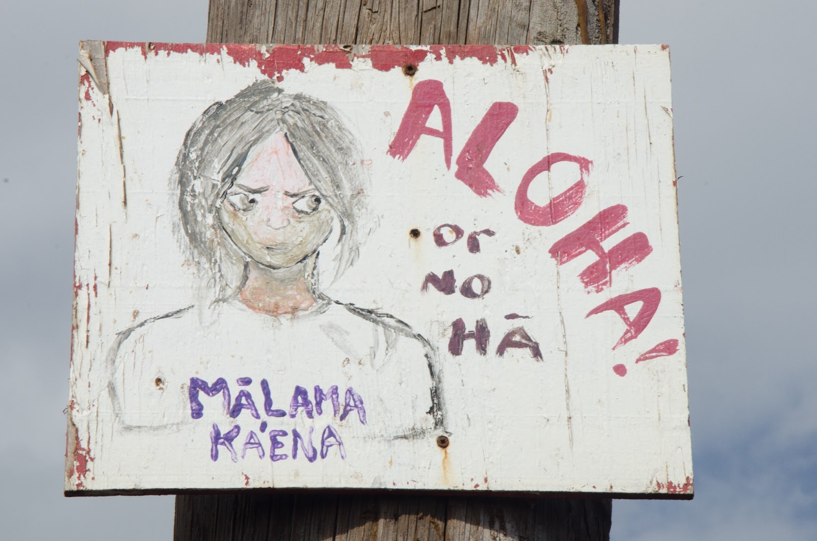
This either means "show love to Ka Ena Point," or "I'm going to steal the valuables out of your car while you're out here."

Ka Ena Point is the western tip of Oahu.  It is about as far away from Waikiki as you can get and still be on this island.  It's also one of the best places to find solitude on an overcrowded island.


At one point in time, they tried to make a road that wrapped all around the point of the island, connecting the Waianae coast and the Hale Iwa north shore coast.  It was a good idea on paper, because the trip from Waianae to Hale Iwa is well over an hour, but is only a few miles as the crow flies.  Unfortunately, mother nature did not agree with this project and decided to sweep away part of the road using her strong ocean currents. The terrain is still passable most of the way using a 4WD vehicle, but it also makes for a spectacularly easy hike.


There are two ways to reach the point, from the west side or from the north side.  I have done the west side before, and it was a pretty incredible stroll along the coastline.  I have twice before attempted the hike from the north shore, and both times I was forced to turn around due to the crabbiness of a toddler.  Well, this time I was prepared (by that I mean without kids).


The trail itself is pretty plain.  As I said, it's a 4WD dirt road that you walk along.  You are treated to views of small mountains to the left, and a rocky ocean shoreline to the right.  There are several coves and lookouts that one can stroll to and along.  Some good views, but mostly nondescript.


The very end of the trail is a nature preserve.  It is somewhat of a bird sanctuary and a monk seal safe haven.  The below sign is posted at the gate to warn people of the dangers of bringing dogs to Ka Ena Point.  After looking at the sign, all I could think of was how much fun my dogs would have digging up the birds out of their holes.  I know, there is something wrong with me.


The terrain gets sandy once you enter the gate.  You walk past bushes and bird holes as you approach the navigational aid.  Next to the navigational aid there is a small, abandoned building.  I read a news story that some artist spray painted a mural on the wall, so that was one of the reasons I was thinking about this hike on this particular day.  The article also said the county considers this graffiti and has already painted over one of this guy's other works.


Now, I'm not really one for art, but I can appreciate what this guy can do with a can of spray paint.  If I tried to do something like this, I would just end up with a brownish blob of paint that roughly resembles the spaghetti stain my kids get on their clothes every time we eat Italian.


Just past the navigational aid is a rocky area where monk seals like to hang out.  I caught this little guy sunbathing while I was eating my snacks.

No Monk Seals were harmed in the production of this blog.

The crab, however, was delicious


While I was resting, I decided to play around with the 105mm macro lens that my dad sent me.  That basically means I can take really up close pictures of small objects.  This thing can really come in handy.


I have been reading books and watching videos by this photographer named Bryan Peterson.  He has a fantastic beginner photography book titled "understanding exposure," where he goes through the basics of exposure theory and makes it easy for the laymen to understand.  Bryan is also big into texture photographs. I decided to try my hand at a few of them while I was out there...

Purple pattern on one of the rocks

Rust on one of the metal boxes lining the nature preserve area

the last time I tried to make brownies

And with that I will leave you with more pictures from the hike.  Enjoy and Mahalo for reading!